— Route
Río Serpis – Port of Gandia
Easy 12.4 km circular route linking the centre of Gandia with the Grau along the Serpis Greenway, between urban heritage, river and sea.
Route video
Route context
A flat, paved and very accessible route connecting the historic centre of Gandia with the Port along the bed of the Serpis river and its Greenway. With no notable elevation gain and on comfortable paths, it suits walking, running or cycling, and lets you cover in a single route the city's commercial heart, the riverside strip, the river mouth and the seafront of the Grau.
Route description
Start at Hotel Borgia
The route is circular: it starts and finishes at Hotel Borgia, right in the centre of Gandia. The first few metres connect with the Passeig de les Germanies, the city's main pedestrian and shopping avenue, along an urban stretch on pavement and tree-lined boulevard, with signal-controlled crossings. The route gradually takes on a riverside feel as it approaches the bed of the Serpis.
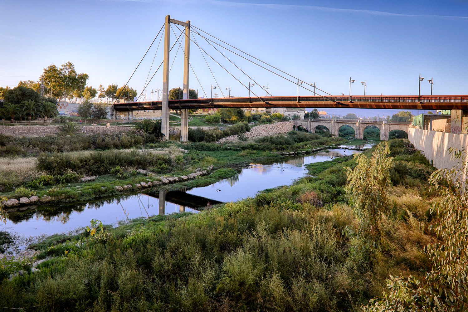
Serpis Greenway towards the sea
The route joins the Serpis Riverbed Greenway, a flat, well-surfaced corridor that follows the river along its final stretch. It is the longest section and the one with the most natural character: riverside vegetation, pedestrian footbridges over the bed and open views towards the Mediterranean as the river nears its mouth.
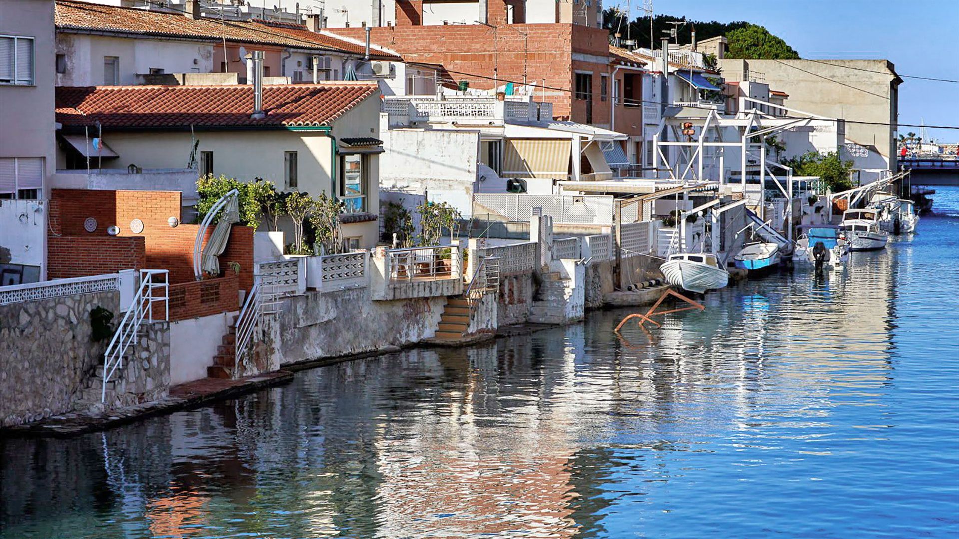
River mouth and Port of Gandia
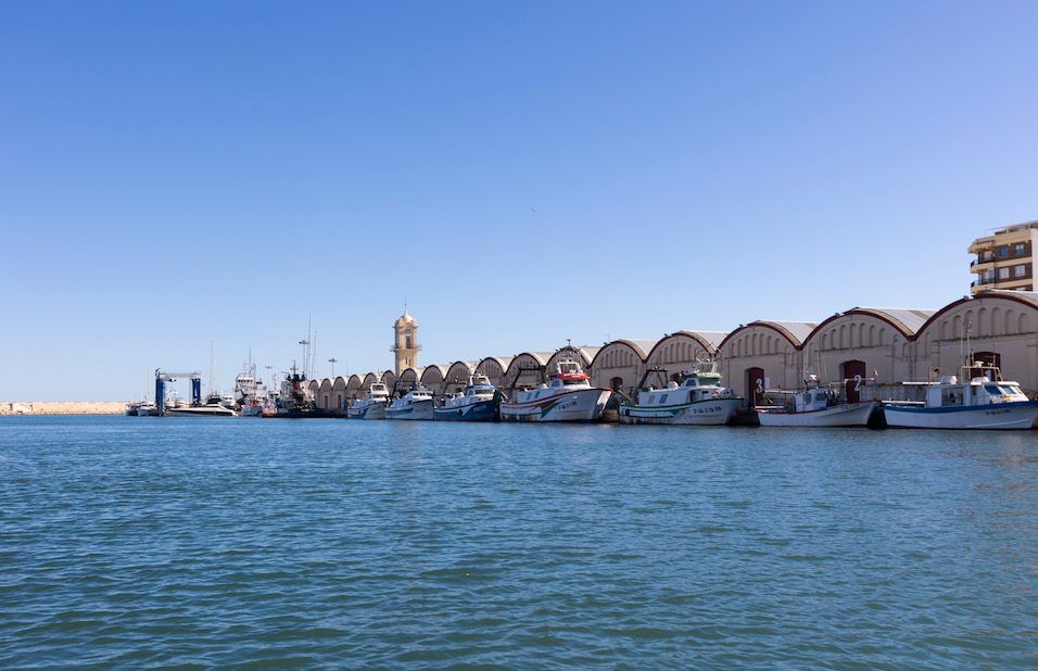
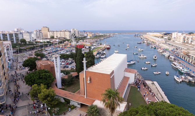
After crossing the river mouth, between Playa de Venecia and the Marenys de Rafalcaid, the route reaches the maritime district of the Grau. It passes the Tinglados del Puerto —old vaulted warehouses from 1908— and the Parish of Sant Nicolau de Bari, and skirts the peculiar Barranc de Sant Nicolau, a small estuary where the sea reaches inland.
Return to Hotel Borgia
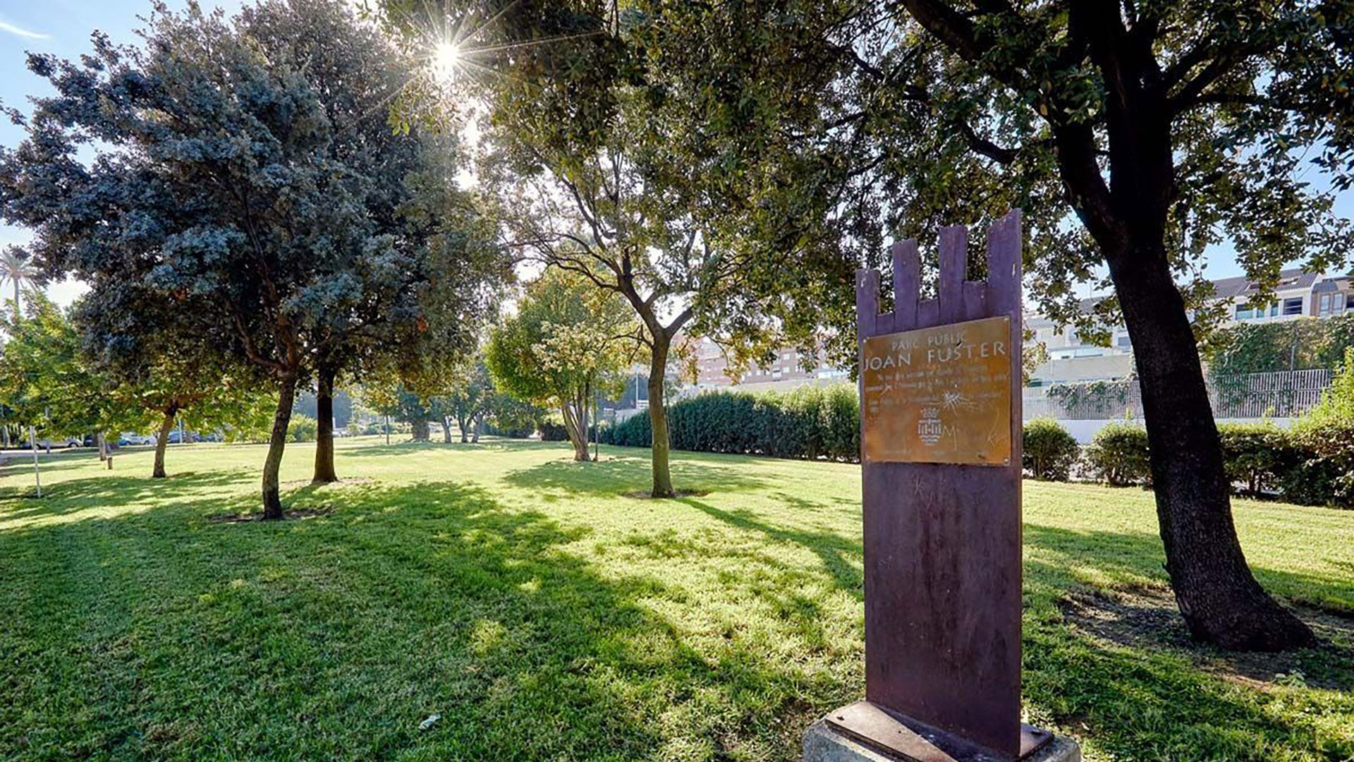
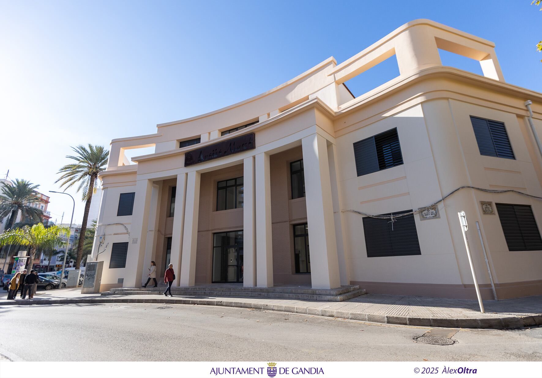
The final stretch heads back towards the centre through Parque Joan Fuster, a landscaped strip that serves as a transition between the Grau and the urban core. The route passes the preserved historic façade of the IES Ausiàs March and closes the loop back at Hotel Borgia, the same starting point.
Points of interest
- Passeig de les Germanies The main pedestrian and shopping artery in the centre of Gandia. A tree-lined boulevard that crosses the city and structures the route's start and return.
- Río Serpis Also known as the Alcoy or Blanco river. One of the main hydrographic axes in the south of the province of Valencia and the north of Alicante.
- Serpis Riverbed Greenway A flat pedestrian and cycle corridor laid out along the riverbed, forming the longest natural stretch of the route.
- Mouth of the Serpis The point where the river enters the Mediterranean, between Playa de Venecia (Grau de Gandia) and the Marenys de Rafalcaid.
- Tinglados del Puerto de Gandia A group of old vaulted warehouses built in 1908 to store and export oranges. Listed as Assets of Local Relevance in the maritime district of the Grau.
- Parish of Sant Nicolau de Bari The main church of Gandia's maritime district, a landmark of 20th-century modern architecture set right in the port.
- Barranc de Sant Nicolau A natural space at the entrance to the Grau where seawater reaches inland, resembling a small estuary.
- Parque Joan Fuster A landscaped ring and urban green strip that acts as a natural transition between the urban core of Gandia and the Grau area.
- Façade of the IES Ausiàs March Historic façade kept as the school's identifying feature after the full refurbishment of the centre opened in January 2026.
Specific precautions
An urban and peri-urban route, with no notable elevation gain, but with long stretches of tarmac and little shade. In summer avoid the midday hours because of the heat and carry enough water. Take care at the crossings on the Passeig de les Germanies and around the Port, where there is vehicle traffic. If cycling, respect pedestrian priority on the Greenway.

— Before you set off
A little preparation
Check these four basics before lacing up your boots.
-
Climate
Dry Mediterranean climate. Avoid midday hours in summer and check the forecast before you leave.
Check the forecast -
Difficulty
The Wikiloc scale captures both terrain and effort in a single rating.
Moderate -
Gear
Hiking boots, enough water, charged phone and a downloaded map/GPS.
Come prepared -
Best season
spring · autumn · winter
Recommended in spring · autumn · winter
Check the weather forecast, carry proper gear and share your route.
Quick checklist
The essentials before you set off.
- Comfortable shoes
- Layered clothing
- Enough water
- Map and GPS
- Sun protection
- Charged phone
Parking
Start and finish at the same point. Free, spacious parking.
Respect nature. Leave only footprints, take only memories.